![](/images/other/stat-length.png)
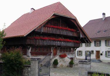
![Tocht Te voet Schmitten (FR) - Schmitten Station - Niedermuhren - Photo](https://media.geolcdn.com/t/1900/400/1ae8506e-df64-4606-b5f7-0ac3d4ec27dc.jpeg&format=pjpeg&maxdim=2)
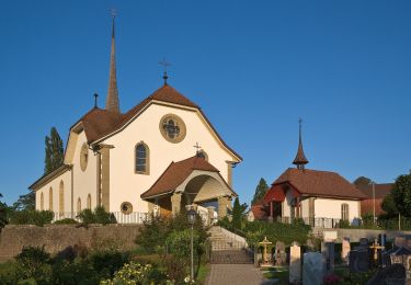
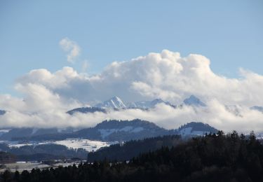
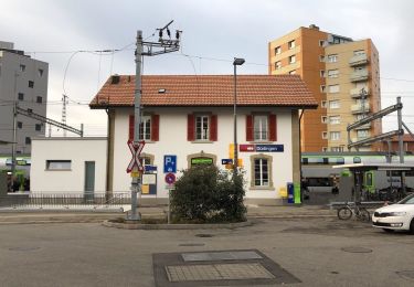
Schmitten Station - Niedermuhren
SityTrail - itinéraires balisés pédestres
Tous les sentiers balisés d’Europe GUIDE+
![Lengte](/images/other/stat-length.png)
Lengte
4,2 km
![Max. hoogte](https://static1.geolcdn.com/siteimages/upload/files/1508320355ic_sort_altitude_max_24dp.png)
Max. hoogte
675 m
![Positief hoogteverschil](https://static1.geolcdn.com/siteimages/upload/files/1508320355ic_sort_den_pos_24dp.png)
Positief hoogteverschil
118 m
![Km-Effort](/images/other/stat-length.png)
Km-Effort
5,6 km
![Min. hoogte](https://static1.geolcdn.com/siteimages/upload/files/1508320355ic_sort_altitude_min_24dp.png)
Min. hoogte
599 m
![Negatief hoogteverschil](https://static1.geolcdn.com/siteimages/upload/files/1508320355ic_sort_den_neg_24dp.png)
Negatief hoogteverschil
59 m
![Boucle](https://static1.geolcdn.com/siteimages/upload/files/16400158638029165_repeat_loop_refresh_sync_direction_icon.png)
Boucle
Neen
Markering
Datum van aanmaak :
2022-02-14 08:45:45.746
Laatste wijziging :
2022-02-14 08:45:45.746
![Te voet](https://static1.geolcdn.com/sitytour/trail-icons/100.png)
1h15
Moeilijkheid : Gemakkelijk
![Scan deze QR-code om de tocht te openen in de SityTrail-applicatie](https://capi.geolives.com/qq0zvz2zws4bq2lad0pu/sitytour/trails/3105919/qr.png?size=200)
Gratisgps-wandelapplicatie
Over ons
Tocht Te voet van 4,2 km beschikbaar op Fribourg/Freiburg, Sensebezirk, Schmitten (FR). Deze tocht wordt voorgesteld door SityTrail - itinéraires balisés pédestres.
Beschrijving
Symbol: gelber Diamant
Plaatsbepaling
Land:
Switzerland
Regio :
Fribourg/Freiburg
Departement/Provincie :
Sensebezirk
Gemeente :
Schmitten (FR)
Locatie:
Unknown
Vertrek:(Dec)
Vertrek:(UTM)
366897 ; 5191437 (32T) N.
Opmerkingen
Wandeltochten in de omgeving
![Tocht Te voet Tafers - Tafers - St. Antoni - Photo](https://media.geolcdn.com/t/375/260/5b7eb474-0b16-4fd8-9121-1947b77fee7f.jpeg&format=jpg&maxdim=2)
![Te voet Te voet](https://static1.geolcdn.com/sitytour/trail-icons/100.png)
Tafers - St. Antoni
Te voet
Gemakkelijk
Tafers,
Fribourg/Freiburg,
Sensebezirk,
Switzerland
![](/images/other/stat-length.png)
4,8 km | 7,2 km-effort
1h 37min
![](https://static1.geolcdn.com/siteimages/upload/files/16400158638029165_repeat_loop_refresh_sync_direction_icon.png)
Neen
![Tocht Te voet Bösingen - Bösingen - Schmitten Station - Photo](https://media.geolcdn.com/t/375/260/d6f1ac76-6e24-4893-bc8a-7f8471a0254b.jpeg&format=jpg&maxdim=2)
![Te voet Te voet](https://static1.geolcdn.com/sitytour/trail-icons/100.png)
Bösingen - Schmitten Station
Te voet
Gemakkelijk
Bösingen,
Fribourg/Freiburg,
Sensebezirk,
Switzerland
![](/images/other/stat-length.png)
6,2 km | 8,2 km-effort
1h 52min
![](https://static1.geolcdn.com/siteimages/upload/files/16400158638029165_repeat_loop_refresh_sync_direction_icon.png)
Neen
![Tocht Te voet Schmitten (FR) - Schmitten - Wiler - Photo](https://media.geolcdn.com/t/375/260/79233bee-5108-4c8f-9bc7-97d1ec230107.jpeg&format=jpg&maxdim=2)
![Te voet Te voet](https://static1.geolcdn.com/sitytour/trail-icons/100.png)
Schmitten - Wiler
Te voet
Gemakkelijk
Schmitten (FR),
Fribourg/Freiburg,
Sensebezirk,
Switzerland
![](/images/other/stat-length.png)
3,9 km | 5,9 km-effort
1h 20min
![](https://static1.geolcdn.com/siteimages/upload/files/16400158638029165_repeat_loop_refresh_sync_direction_icon.png)
Neen
![Tocht Te voet Wünnewil-Flamatt - Flamatt Sport - Wünnewil - Photo](https://media.geolcdn.com/t/375/260/cf234808-c507-4762-9a26-954d66b1c9cd.jpeg&format=jpg&maxdim=2)
![Te voet Te voet](https://static1.geolcdn.com/sitytour/trail-icons/100.png)
Flamatt Sport - Wünnewil
Te voet
Gemakkelijk
Wünnewil-Flamatt,
Fribourg/Freiburg,
Sensebezirk,
Switzerland
![](/images/other/stat-length.png)
4,7 km | 6,5 km-effort
1h 29min
![](https://static1.geolcdn.com/siteimages/upload/files/16400158638029165_repeat_loop_refresh_sync_direction_icon.png)
Neen
![Tocht Te voet Wünnewil-Flamatt - Flamatt / Station - Ueberstorf - Photo](https://media.geolcdn.com/t/375/260/cf234808-c507-4762-9a26-954d66b1c9cd.jpeg&format=jpg&maxdim=2)
![Te voet Te voet](https://static1.geolcdn.com/sitytour/trail-icons/100.png)
Flamatt / Station - Ueberstorf
Te voet
Gemakkelijk
Wünnewil-Flamatt,
Fribourg/Freiburg,
Sensebezirk,
Switzerland
![](/images/other/stat-length.png)
3,6 km | 5,3 km-effort
1h 12min
![](https://static1.geolcdn.com/siteimages/upload/files/16400158638029165_repeat_loop_refresh_sync_direction_icon.png)
Neen
![Tocht Te voet Düdingen - Düdingen - Garmiswil - Photo](https://media.geolcdn.com/t/375/260/908b1d5b-c8e8-40a5-bd1d-4d93a0191dbe.jpeg&format=jpg&maxdim=2)
![Te voet Te voet](https://static1.geolcdn.com/sitytour/trail-icons/100.png)
Düdingen - Garmiswil
Te voet
Gemakkelijk
Düdingen,
Fribourg/Freiburg,
Sensebezirk,
Switzerland
![](/images/other/stat-length.png)
3,9 km | 4,8 km-effort
1h 5min
![](https://static1.geolcdn.com/siteimages/upload/files/16400158638029165_repeat_loop_refresh_sync_direction_icon.png)
Neen
![Tocht Te voet Düdingen - Jetschwil - Uebewil - Photo](https://media.geolcdn.com/t/375/260/1654cd0b-5775-4894-a335-3cda62e10ecc.jpeg&format=jpg&maxdim=2)
![Te voet Te voet](https://static1.geolcdn.com/sitytour/trail-icons/100.png)
Jetschwil - Uebewil
Te voet
Gemakkelijk
Düdingen,
Fribourg/Freiburg,
Sensebezirk,
Switzerland
![](/images/other/stat-length.png)
4,4 km | 5,5 km-effort
1h 15min
![](https://static1.geolcdn.com/siteimages/upload/files/16400158638029165_repeat_loop_refresh_sync_direction_icon.png)
Neen
![Tocht Te voet Tafers - St. Antoni - Niedermuhren - Photo](https://media.geolcdn.com/t/375/260/424877c7-6824-4210-a560-115996086c9e.jpeg&format=jpg&maxdim=2)
![Te voet Te voet](https://static1.geolcdn.com/sitytour/trail-icons/100.png)
St. Antoni - Niedermuhren
Te voet
Gemakkelijk
Tafers,
Fribourg/Freiburg,
Sensebezirk,
Switzerland
![](/images/other/stat-length.png)
3,4 km | 4 km-effort
55min
![](https://static1.geolcdn.com/siteimages/upload/files/16400158638029165_repeat_loop_refresh_sync_direction_icon.png)
Neen
![Tocht Te voet Schmitten (FR) - Schmitten Station - Richterswil - Photo](https://media.geolcdn.com/t/375/260/1ae8506e-df64-4606-b5f7-0ac3d4ec27dc.jpeg&format=jpg&maxdim=2)
![Te voet Te voet](https://static1.geolcdn.com/sitytour/trail-icons/100.png)
Schmitten Station - Richterswil
Te voet
Gemakkelijk
Schmitten (FR),
Fribourg/Freiburg,
Sensebezirk,
Switzerland
![](/images/other/stat-length.png)
3,2 km | 4 km-effort
55min
![](https://static1.geolcdn.com/siteimages/upload/files/16400158638029165_repeat_loop_refresh_sync_direction_icon.png)
Neen